
Carroll County Related Maps
Carroll County Cemetery Locations
Carroll County Government has produced a map showing cemetery locations in the County (external link).
PDF map of Carroll County Cemetery Locations.
Taneytown
The Original Layout of Taneytown - Completed and Recorded in 1762 (Prepared by Arthur G. Tracey, Hampstead, MD.)
- Original Plots
- Original Land Owners
- Original Land Owners with Deed Information - researched by Jeff Duvall
- Diagram of the Town of Taneytown - 1887 (Digital Maryland; external link)
Westminster
- 1877 Map of Westminster
- Original Westminster Lot Lease Owners researched by Jeff Duvall
Election District Maps
- 1797 Frederick County Election District
- 1798 Old Baltimore County Hundreds
- 1798 Tax Assessment Map of Frederick County Hundreds
- 1808 Frederick County Election Districts
- 1808 Varle Map
- 1825 Frederick County Election Districts
- 1837 Original Carroll County Election Districts
- 1880 Carroll County Election Districts
- Current Carroll County Election Districts
Additional Carroll County Maps
- 1824 Land Record - Priestland - Shows the road from Evan McKinstry's Mill on Sam's Creek, to Uniontown.
- 1862 Martenet's Map of Carroll County, Maryland
- 1862 Martenet's Map - Interactive (MSA website, external link)
- 1863 Military Map of Carroll County
- 1873 Plat of Union Bridge, Carroll County
- 1911 Postal Map - Rural Delivery
Railroad Maps
- 1831 Baltimore & Ohio Survey Map - (pre-Carroll County)
- 1858 Baltimore & Ohio main and tributary railroad lines
Baltimore Maps
- 1857 - Map of the Baltimore City and County (Maryland).
- 1869 - E. Sachse, & Co.'s bird's eye view of the City of Baltimore.
Early Landowners in North Central Maryland
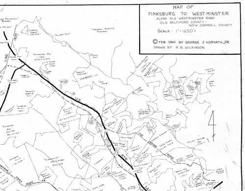
In the late 1970s and 1980s, George Horvath plotted early land patents on current tax maps. He did the research and worked with others (Robert Brent Wilkinson, Michael J. Brown and R. J. Dickinson) to create area maps showing these land records. These efforts exist because of George’s interest in the value of land records for genealogical research and because of the Tracey collection at the Historical Society of Carroll County. Paper copies of these maps are available in our collection at the Westminster library and are now available through our website for your research.
Carroll County
- Early Cox’s Town (now Hampstead)
- Early Landowners 1798 (Liberty Road - Rte 26, north to Gamber Road - Rte. 91)
- Eldersburg
- Finksburg to Westminster
- Sykesville
- Taneytown
- Union Bridge
- Winfield
- Winfield to Eldersburg
Baltimore County
- Early Patents and Roads (Reisterstown Area)
- Elkridge to Ellicott's Upper Mills
- Granite
- Greenspring Valley
- Owings Mills
- Pikesville
- Randallstown
- Rayville to MD Line
- Ruxton-Riderwood
- Wards Chapel Church
Maryland Maps
- 1767 Map of Virginia and Maryland
- 1768 Map of Maryland and Pennsylvania - Mason Dixon Line Map
- 1794 Map of Maryland as drawn in 1933
- 1795 Map of Maryland as drawn from actual surveys
- 1795 Map of Maryland from the best authorities
- ca1827 Map of Maryland
- 1841 Map of Maryland
- 1865 Map of Maryland - Antebellum Maryland, an Interactive Map
Historical Maps
The Tracey Map: From Maryland Special Collections, this digital image scan from a hand-drawn map by Grace Tracey showing the entire county with Dr. Arthur Tracey’s information on roads, Indian trails, waterways, land patents before 1756, etc. Unknown date, late twentieth century. Original size: 32” by 32.”
Joshua Fry Map - 1755 - A map of the most inhabited part of Virginia containing the whole province of Maryland with part of Pensilvania, New Jersey and North Carolina. From the Library of Congress
Postal Map - Published c.a. 1796 - A map of the United States exhibiting post roads & distances: the first sheet comprehending the nine northern states, with parts of Virginia and the territory north of Ohio. From the Library of Congress
England and Wales Jurisdictions 1851
Maryland in Liberia 1853 - This area is mentioned in Frederick County Manumission Documents when freed slaves were to leave Maryland and go to Liberia.